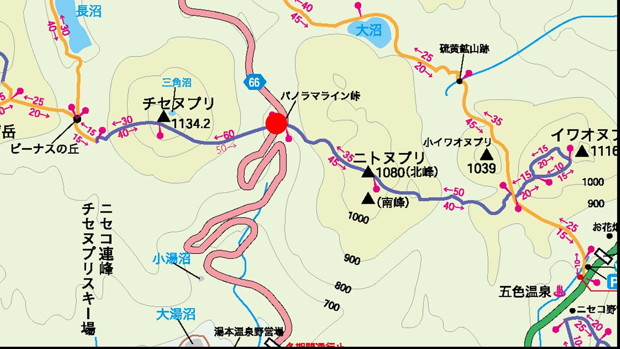
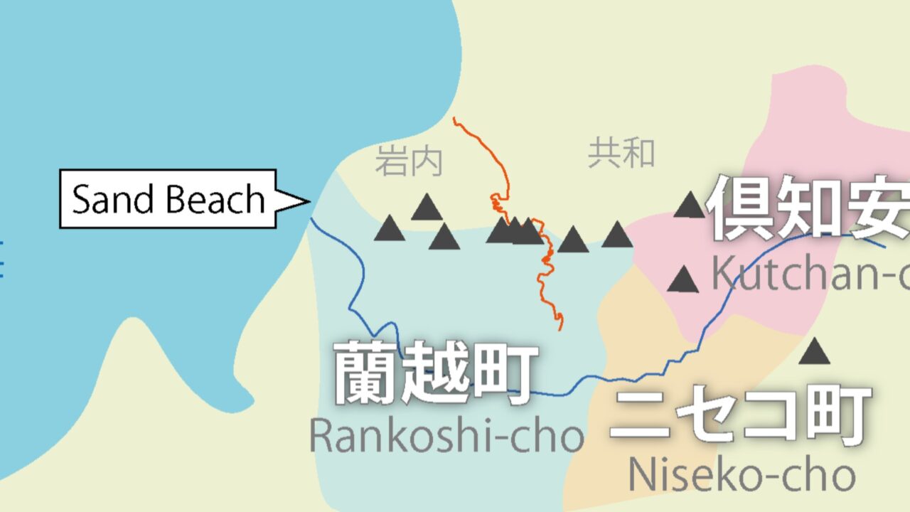
Niseko Mountains and Panorama line
Video to improve the image of Rankoshi Town
This video was created to brand Rankoshi Town.
The Breath of Life and Land
The subtitle “The Breath of Life and Land” literally means “the breath of life and the earth”. However, “The Breath of Life” also means “the purpose of life”. “The purpose of life” is one answer to the question “What do we live for?” Or it means the value of life or the quality of life. Furthermore, “the purpose of life” also has a meaning that is related to the word “wellness”. (Details will be described later)
The “breath of the earth” is the wind that is created by the influence of the climate and topography. It means the wind that brings powder snow in winter and freshness in summer.
Overall, the wind, which is likened to the breath of the earth, brings change to the earth, and people shine vividly there.
Video Outline
Summer when the Panorama Line connects to the sea
In the summer, many riders come to Hokkaido for touring, and riders from all over the country come to the Panorama Line.
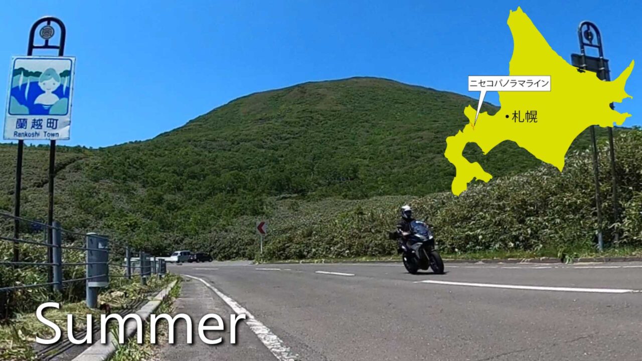
The scenic southern road of the Niseko Panorama Line runs through Rankoshi Town.
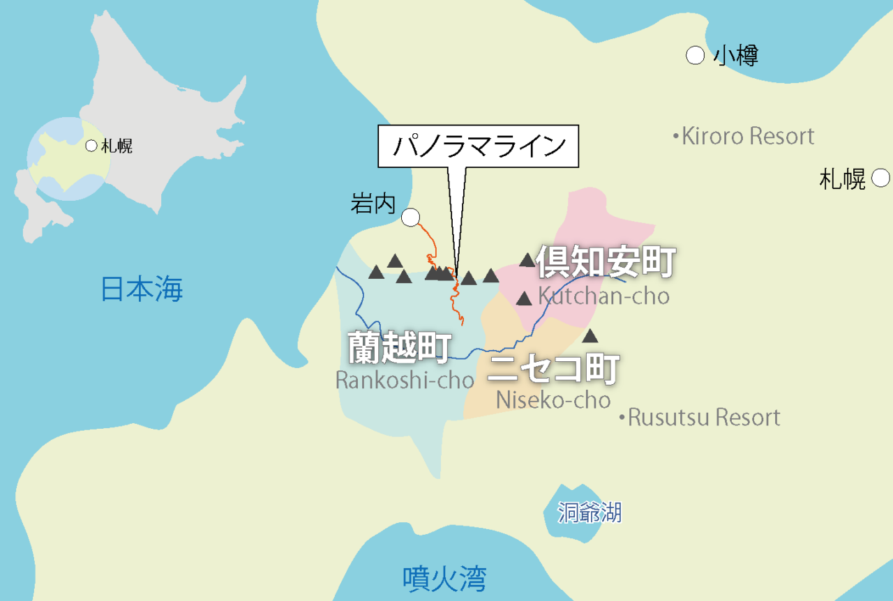
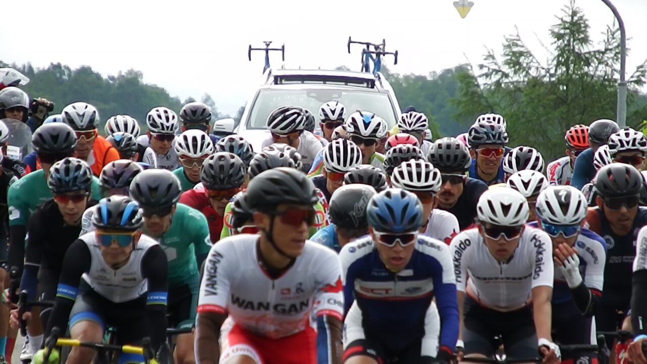
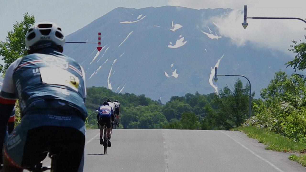
The NISEKO CLASSIC bicycle race, held every June, passes through the Panorama Line as a mountain pass crossing section. The scenic course that follows passes through the Ura Panorama.
Ura Panorama is a bypass route that crosses Niimi Pass. If you combine the Ura and Umote Panorama Roads, you can go around Chisenupuri.
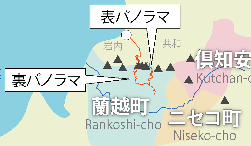
At the end of the bicycle race, many participants will be soothed by the view of Mt. Yotei floating beyond the gentle hills as they pass through Asahidai after finishing the final climb.
Niseko Mountain Range in winter
Why does powder snow fall in the Niseko mountain range?
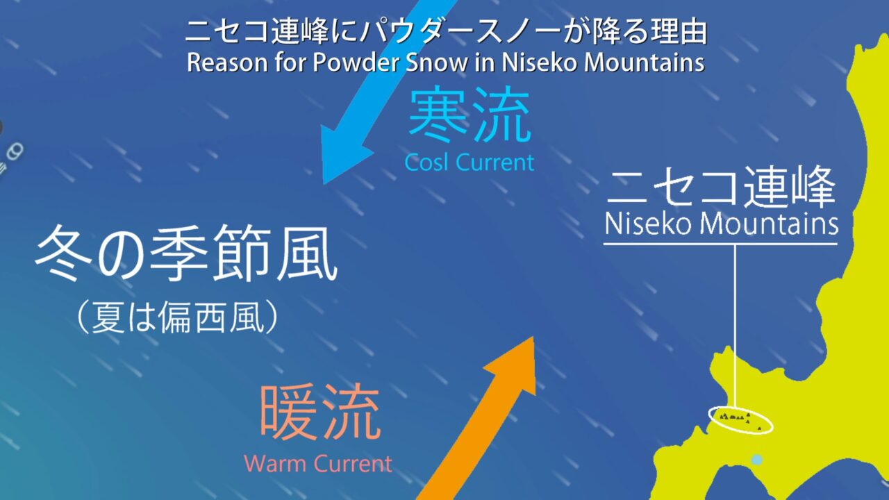
The winter monsoons blowing from the continent are influenced by the warm Tsushima Current and the cold currents flowing from Siberia as they cross the Sea of Japan, bringing with them just the right amount of moisture without being too humid. When it hits the Niseko mountain range, it cools rapidly as it rises and is released as dry powder snow.
The Niseko mountain range is characterized as a snow resort by the abundance of powder snow, which exceeds that of the European Alps, a chain of mountains over 4,000 meters high, located just a short distance from the town.
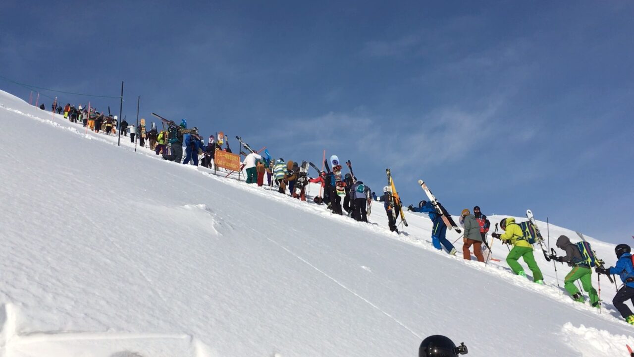
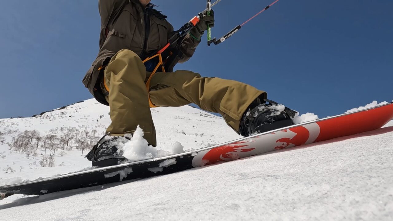
Many skiers hike up in search of the backcountry that lies beyond the gate.
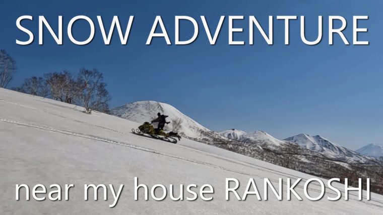
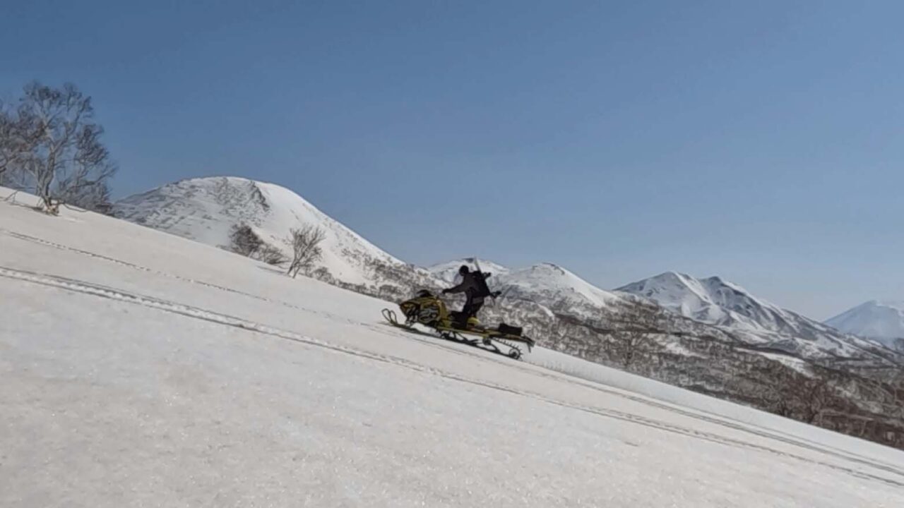
Snowmobile
I live at the foot of the Niseko mountain range, and can access the backcountry from my house by snowmobile. I took my snowmobile up to the base of Mt. Shakunage.
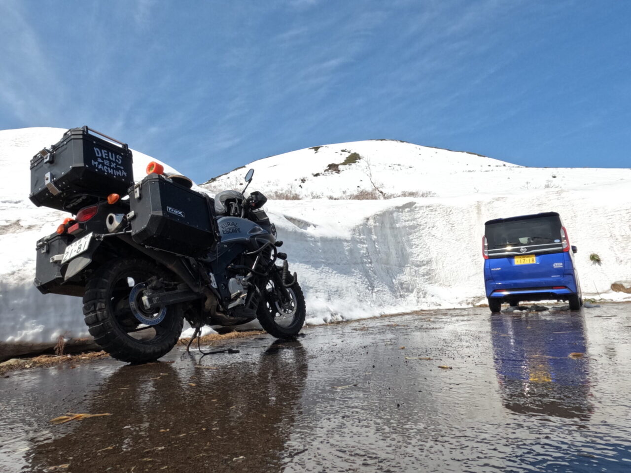
Spring, when the gate opens and the Panorama Line opens
I headed to the parking lot at the highest point on my motorcycle with my snowboard.
This is also the intersection with the hiking trail that runs through the Niseko mountain range, and many skiers come here to enjoy spring skiing immediately after the opening. Motorbikes and bicycles, who have been waiting for the opening, are arriving in droves.
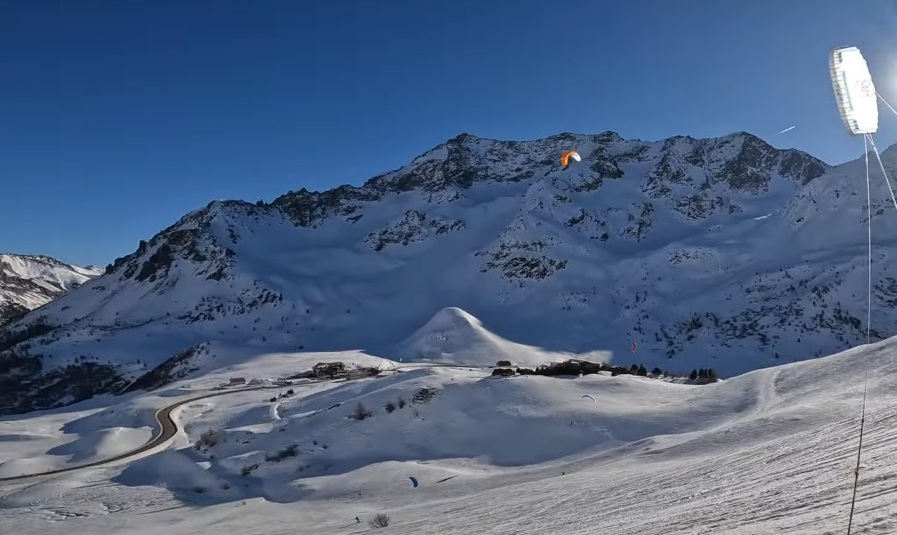
Snow kiting at the highest point of the Panorama Line
Snowkiting right next to the Panorama Line Pass parking lot. Enjoy the gentle slopes of Chisenupuri and the ability to turn right next to the road.
A similar view to the snowy Niseko Panorama Road can be found in the French Alps. The location is Col du Lautaret, a pass that passes through the Alps, a chain of 4,000m-class mountains, halfway between Turin, Italy and Lyon, France. The highest point of the pass is 2,058m above sea level, and it is passable even in winter.
This place is a mecca for snowkiting, with a winding road in the middle of the backcountry, and there are many impressive videos of snowkiting on the side of the road.
The biggest attraction of the Tour de France, the most popular bicycle road race in the world, is crossing the Alps. The highest peak in the past was the Col du Galibier, whose highest point is 2,645m above sea level. Col du Galibier is the road that leads to the north side of Col du Rothét.
Descending to the sea and heading to Iwanai Shrine
As you descend the Panorama Line toward the sea, the sea peeks out from between the trees. After the pass, the countryside unfolds and the road continues to the sea.
Entering the city, we saw the cherry blossoms at Iwanai Shrine. This year, the opening of the Panorama Line coincided with the cherry blossoms blooming, so we were able to enjoy a variety of scenery.

The white mountain surface of Mt. Iwanai, visible beyond the torii gate, is beautiful.
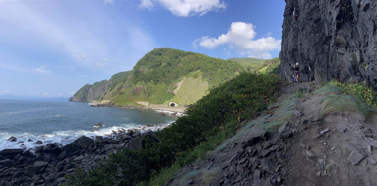
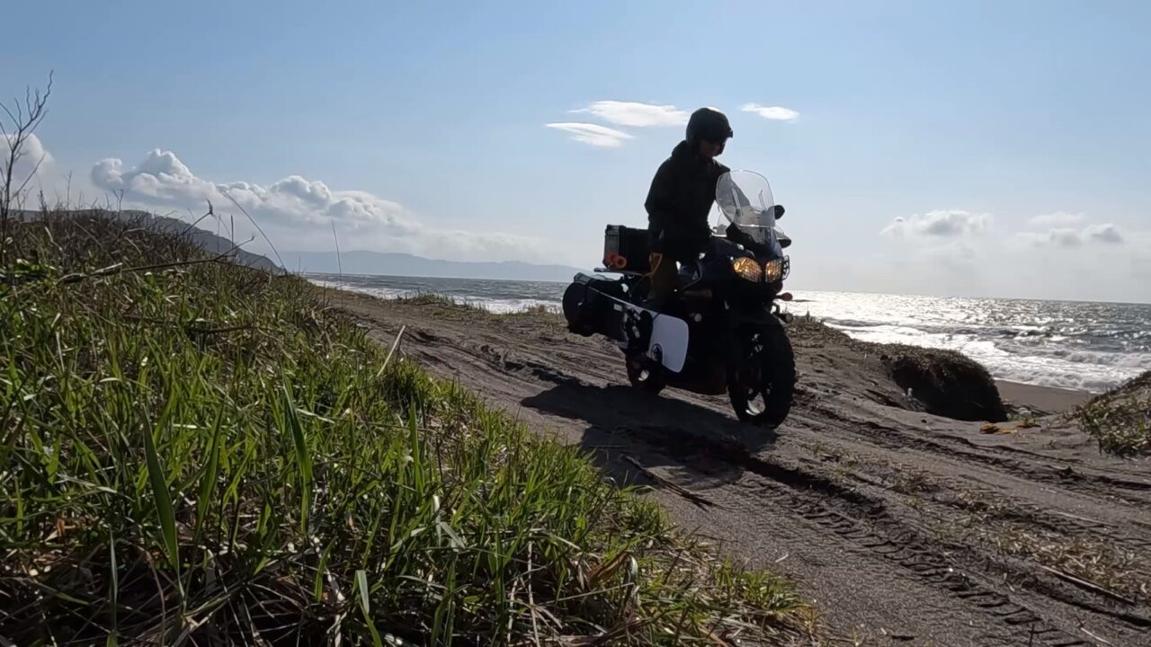
Go through the tunnel and head to the sandy beach of Rankoshi
Head south along the coastal road. After passing through several tunnels, you will come across Sebachi Rock, a climbing point with a spectacular view facing the sea, just after entering Rankoshi Town. In the distance, you can see Benkei’s Shoulder Rock.
Once you pass through the last tunnel, the sandy beach of Rankoshi spreads out before you.
From Hakodate to Shakotan, there are many stony coasts, but sandy beaches are rare. I took a short ride along the seaside.
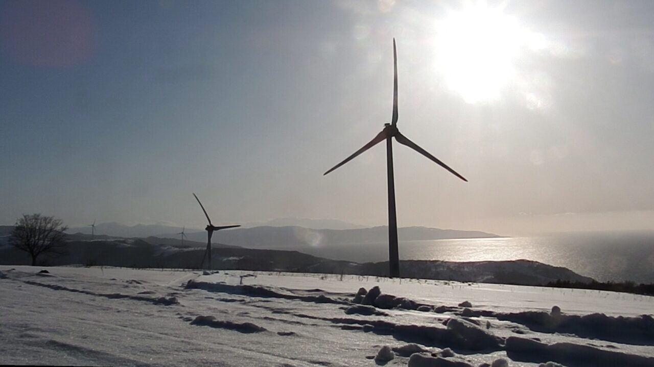
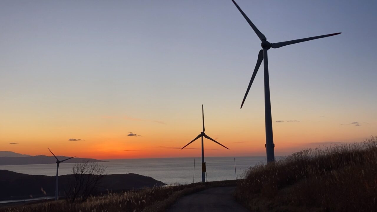
Former Isotani Ranch
Two weeks later, I headed to the windmills at the former Isotani Ranch.
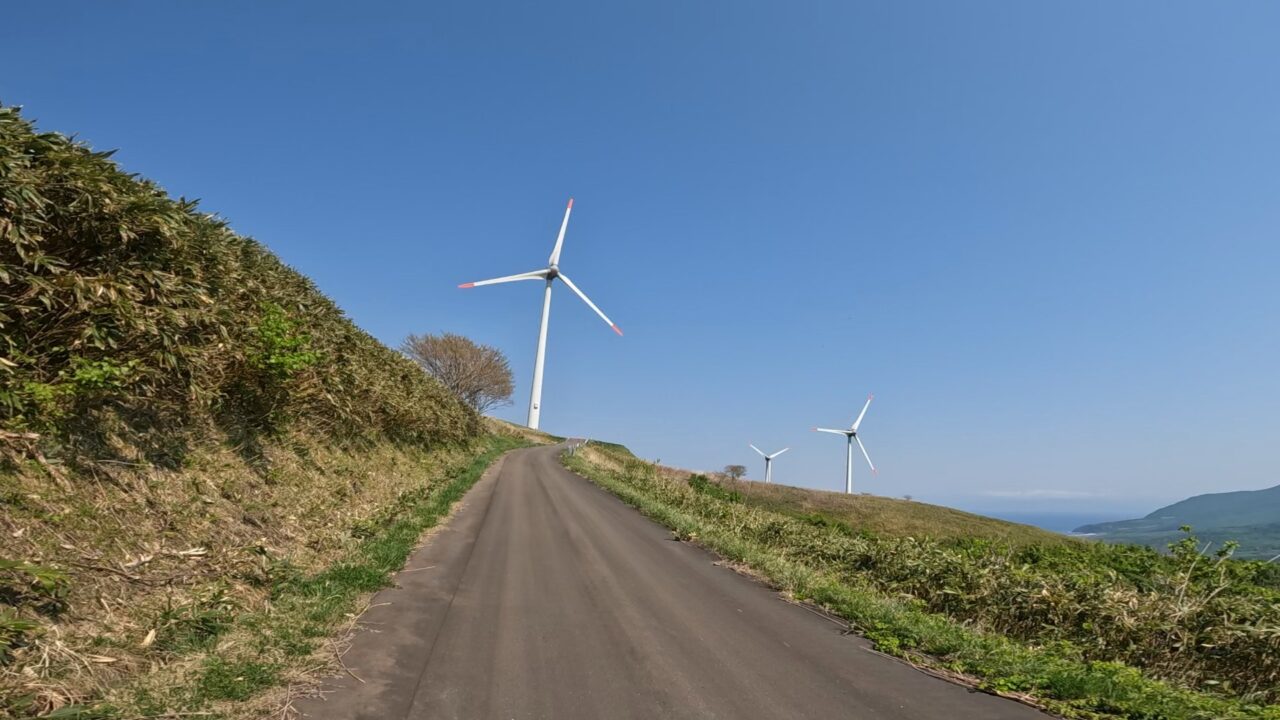
This is a hill overlooking the Niseko mountain range in the distance, and the ocean looks beautiful.
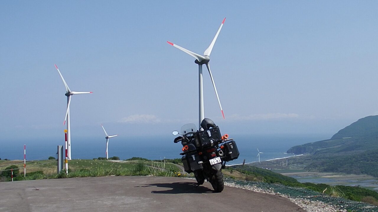
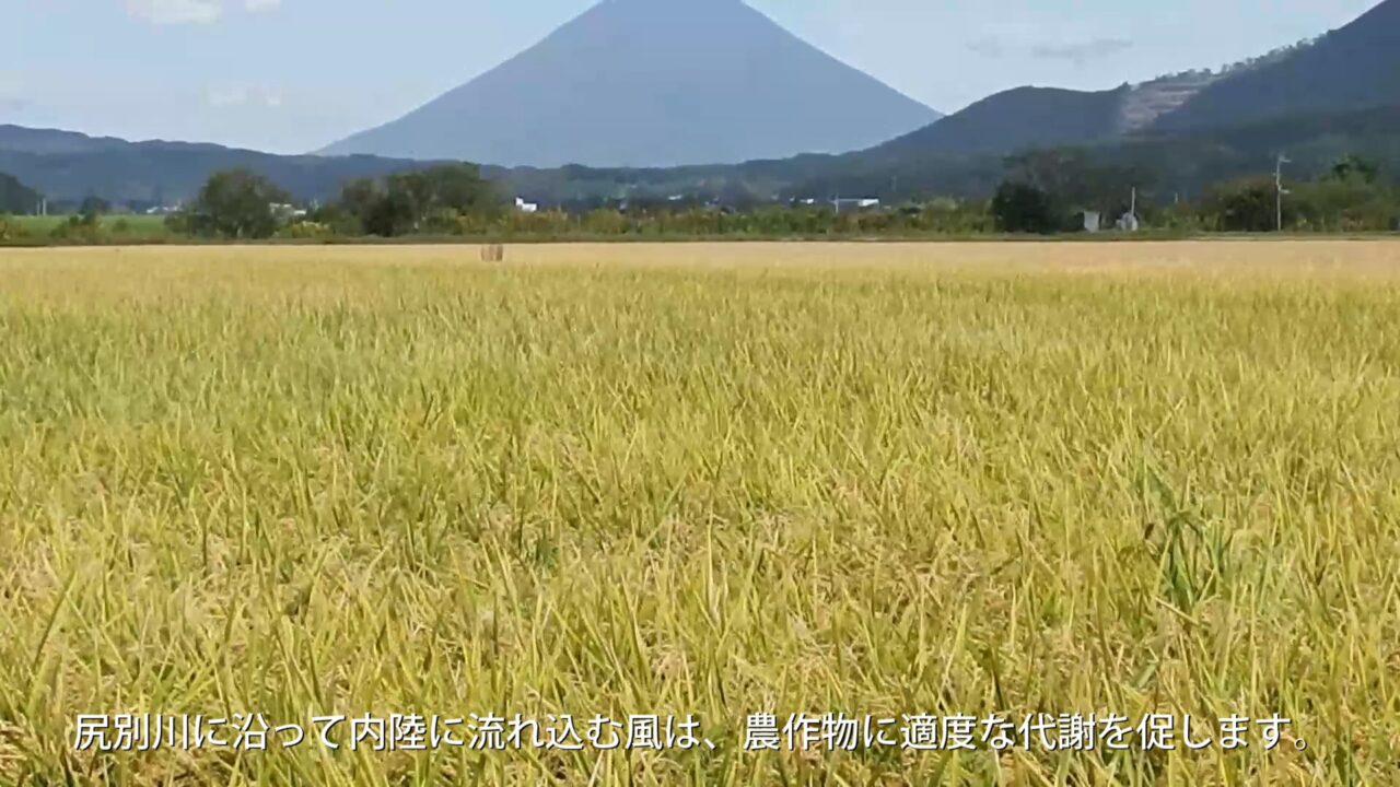
Rankoshi, which is crossed by the Shiribetsu River and connects to the sea on the west side, is prone to westerly winds.
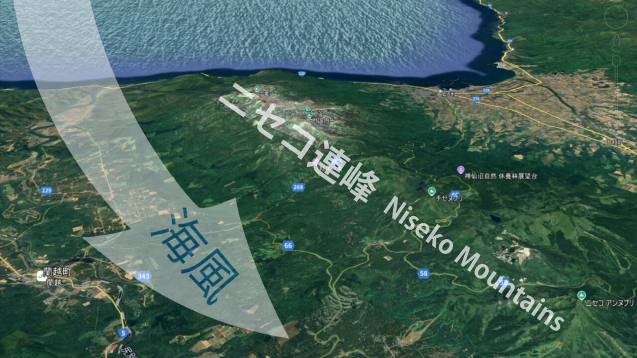
The wind that flows inland along the Shiribetsu River promotes moderate metabolism in crops.
The unique and varied terrain surrounding the Niseko mountain range offers opportunities to interact with and play in nature. This rich natural environment has attracted people to Niseko.
Ending
The wind brings plenty of powder snow in winter and freshness to the land in summer
On that land, people freely and openly enjoy their lifestyles.
Niseko will surely continue to be a gathering place.
Follow me!