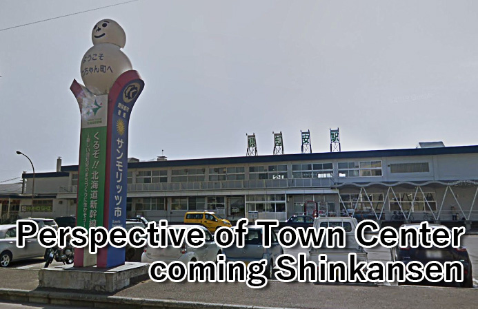
Rebuilding Kutchan Station and Redesigning the Town Center
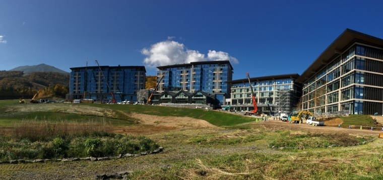
The opening of the Shinkansen new station is scheduled for 2030. Kutchan-cho is discussing how to redesign the city center area in front of the station, aiming for completion in the same year. If you look at the public relations, you can see how the contents of redevelopment are decided. On the surface, redevelopment seems to be progressing democratically. However, the reality is that towns are created uniformly throughout the nation, regardless of local opinions.
This is because the Ministry of Land, Infrastructure, Transport and Tourism and the National Police Agency at the national level do not have the flexibility to design road traffic, which is the basis of city planning.
Although publicly publicized as if it had been decided democratically, I would like to raise the problem that there is actually no local autonomy or democracy. First of all, the contents that have been publicized so far are summarized on this page.
The ABC of City Planning in Japan
Since Japan has adopted a strong centralization system, the influence of the City Planning Act is extremely strong. So all kind of city planning is basically regulated by Land Use Zones under the City Planning Act.
Then the only projects that local governments actually implement are roads and public facilities. The landowners are free to build buildings within the limits of zoning. There are almost no cases of building agreements by landowners.
Various kinds of Plannings
Kutchan-cho has a “Master Plan” in line with the City Planning Act. Based on the master plan, the “Kutchan Town Comprehensive Plan” was formulated. In response to the establishment of a new Shinkansen station in Kutchan, the Town Development Review Committee has formulated the “Machizukuri Proposal Document Around the Hokkaido Shinkansen Kutchan Station”. The “Hokkaido Shinkansen Kutchan Station New Station Area Development Plan” was created. All of these have the formal aspect of “provided by the local government with the will of local people”.
- Kutchan Town City Planning Master Plan Ja
- Kutchan Town Comprehensive Plan (2008-2019) Ja
- Proposal for community development around Kutchan Station of the Hokkaido Shinkansen Ja
- Hokkaido Shinkansen Kutchan New Station Area Development Plan Ja
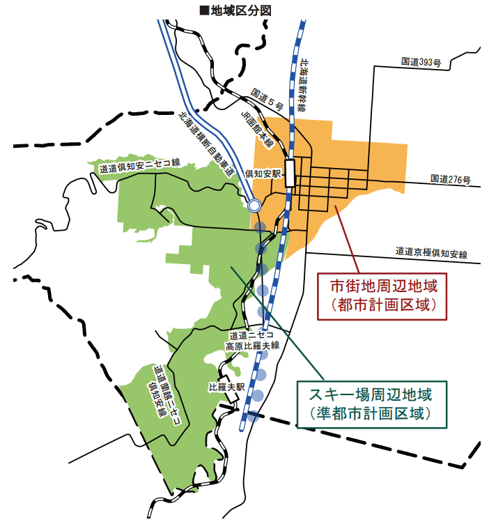
In urban areas, almost all areas are zoned into City Planning Areas and designated as restricted areas such as First-class Residential Areas and Commercial Areas. However, in local cities, there are many local governments that do not have City Planning in the first place. And in Kutchan Town, only a limited area around the station is designated as a City Planning Area. Niseko-cho and Rusutsu-mura have no City Plans. And because there was a development demand near the ski area from the center of the town, Quasi-city Planning Areas were designated in Kutchan-cho and Niseko-cho.
Everything depends on Land Use Zones after all
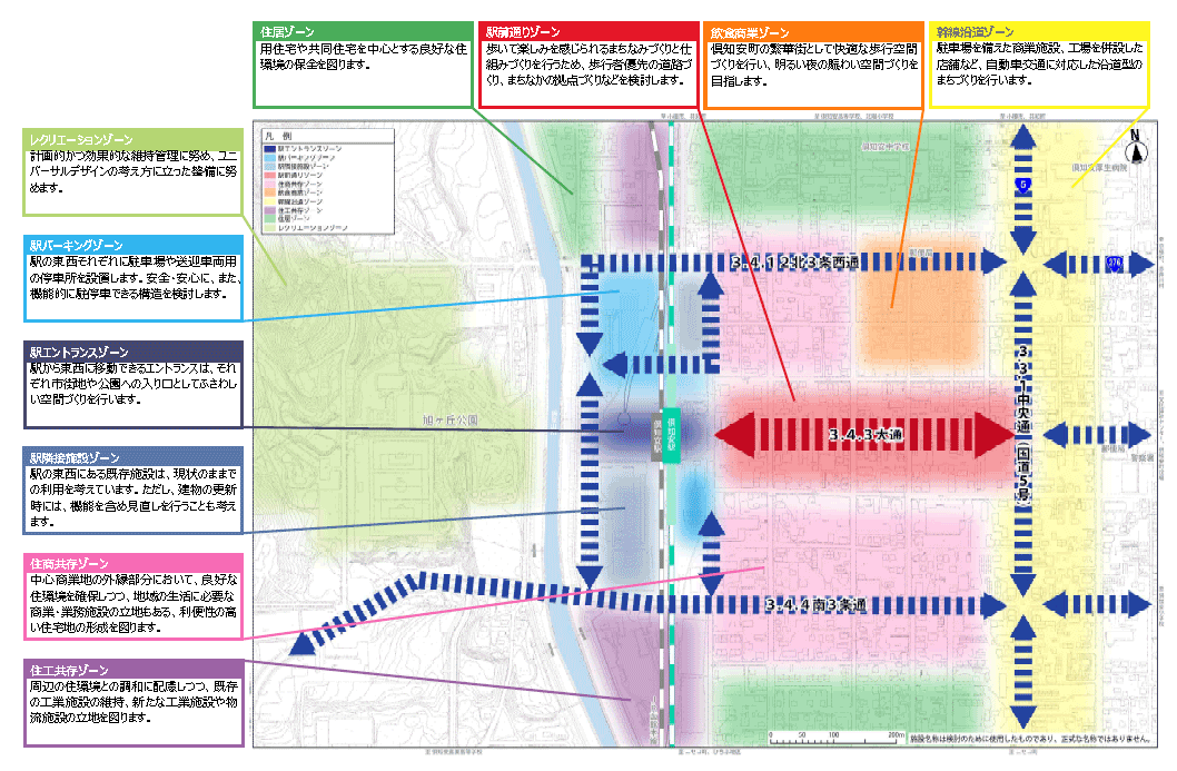
The Hokkaido Shinkansen Kutchan New Station Development Plan provides specific considerations regarding the entrance and exit of the station building and surrounding cars. However, how to design the entire area is abstract, and no specific guidelines are given. It’s only a little added to Land Use Zones of City Planning Act.
The use area is the area division when specifying the area to promote urbanization in the city planning area, and the presence or absence of redevelopment is not related.
Zones on the Plan
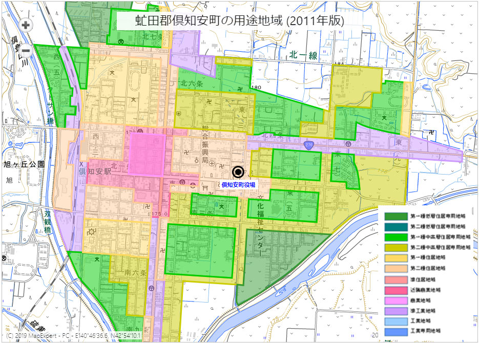
The following figure is excerpted from “Hokkaido Shinkansen Kutchan New Station Development Plan”. Each zone shown there corresponds to Land Use Areas.
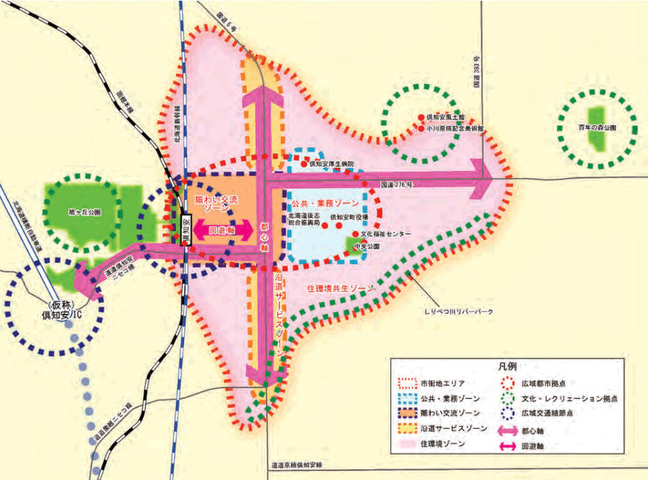
Diagram showing zones
The above figure is excerpted from 2-4 in “Hokkaido Shinkansen Kutchan New Station Area Development Plan”. Color-coded zones are consistent with the Land Use Zones of City Planning Act.
Overview of the Systems
City Planning Area
| Land Use Zones | Formulated for every City Planning Area |
| Master Planning Measures | Formulated for every City Planning Area |
| Urbanization Area | No Urbanization Area has been established in Kutchan Town. |
Status of implementation
| City Planning (use area) | Urbanization Area | |
| Kutchan, Hokkaido | Yes (see usage area map) | N/a |
| Niseko, Hokkaido | N/a | N/a |
| Rangoe, Hokkaido | N/a | N/a |
| Makkari, Nagano | N/a | N/a |
| Rujutsu, Nagano | N/a | N/a |
| Kyogoku, Hokkaido | N/a | N/a |
| Kyowa, Hokkaido | N/a | N/a |
| Iwauchi, Hokkaido | Yes (see usage area map) | N/a |
| Otaru, Saitama | Yes (see usage area map) |
Necessity of development application
| Area | Scale sized that does not require permission |
| Urbanization Area | Less than 1,000m2 or less than 500m2 |
| City Planning Areas for which area classification severance scans are not specified | Less than 3,000 sqm |
| Outside the Quasi-city Planning Area | Less than 5,000 sqm |
| Outside the City Planning Area and Quasi-city Planning Area | Less than 10,000 sqm |
Impressions
This article was created to show clearly how the redevelopment in front of Kutchan Station is planned.
The problem I think is that local governments cannot adopt their own measures because the national government controls too much. I have no intention of denying the efforts of people involved in local autonomy.
Problems about City Planning/designing in Japan are as follows:
- Road maintenance is completely separated from the Ministry of Land, Infrastructure, Transport and Tourism, and road traffic is separated from the National Police Agency at the national level.
- Police management is too strong and untouchable, so local governments cannot control parking management.
- Even in the countryside where cars are essential, the same urban development as in cities is carried out.
In addition, I plan to create a separate article about a proposal for creating a city with parking management.
Follow me!